Trip Level
Moderate Strenuous
Destination
Bhutan
Max Altitude
4820 meter
Trip Duration
13 Days
Overview
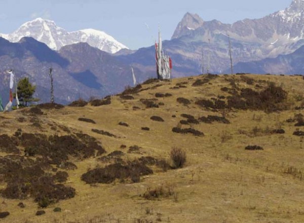
Chomolhari trek isoff-the-beaten path, high altitude trekking but not very long. We also have chance to see the Tiger Monastery and the sites of Paro and the capital, Thimphu.Sadly modern life has encroached on this route to some degree, with an electricity supply following the trail up the Paro Valley. However, look beyond the wires and you will be treated to amazing scenery that ranges from the picturesque valleys of Paro and Thimphu, to the incredible mountain vistas of Chomolhari (7314m), Jichu Drake (6794m) and Tshrim Khang. Throughout the trek you will be weaving your way through Rhododendron forests and over glacial streams.
Outline Itinerary
Detailed Itinerary
Day 01: Arrive Paro and Thimpu transfer
Open arrival at Airport, we will received by our representative and transfer to Thimphu. Overnight at the hotel in Thimphu.
Day 02 : Paro sightseeing
Visit Drukgyel Dzong, Ta Dzong (National Museum), Rinpung Dzong and Kyichu Lhakhang. Overnight at the hotel in Paro.
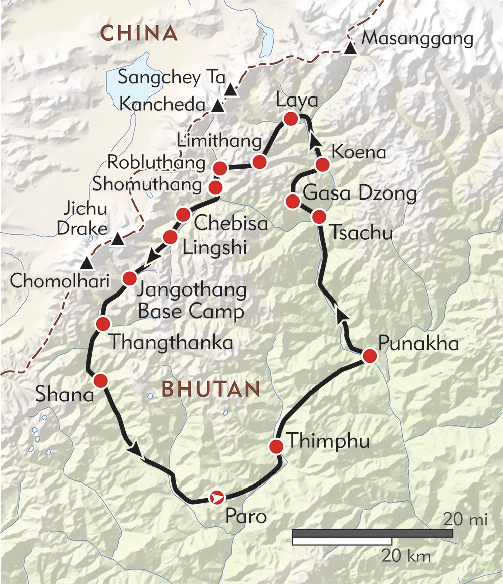
Day 03: Trek to begin Drugyel Dzong to Shana (17km, 5-6 hours)
First day of the trek follows Paro Chhu valley climbing up the ridges. The actual trek starts from Drukgyel Dzong at 2580 m. From here you look back to see how dzong was positioned. After covering short distance you will find settlement of Chang Zampa. A further walk takes to settlement of Mitshi Zampa finding little shops and hotels.The valley widen and you will reach at army post of Gunyitsawa at 2810 m, there are also primary schools and shops.
Day 04: Shana to Soi-Thangthangka (22km, 6-7 hours)
The trek continuous at side of Pa chhu through conifers and rhododandron coming across Jigme Dorji Wangchuk National Park. By making gentle climb on the rock through oak, crossing several steams come across Phari Dzong of Tibet. Then climb little ridge, cross the Paro Chhu on a wooden bridge. Finally come across Thangthangka at 3630 m, where Bhutanese style house are there.
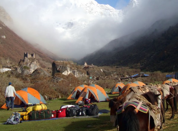
Day 05: Soi-Thangthangka-Jangothang(Base camp Mt.Jumolhari,19km, 5-6 hours)
At night Jumolhariis covered with cloud, but be sure to view early in the morning. Jumolhariappears behind the a ridge. Less than an hour from camp at 3730 m is army post. A short climb leads to small chorten finding yak country. Making further climb come across Takethang, clustered of stone houses on plateau at 3940 m.
Day 06: Day halt for altitude acclimatization/excursion
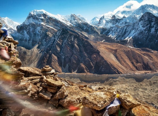
Here is best viewpoint, you won’t get better any better than here. The ridge is endless, after an hour of climb you can view Jichu drake (6989 m) and Jumolhari. If you like to see much of the country better to trek Nyile La to Lingzhi.
Day 07: Jangothang to Lingshi(18km, 5-6 hours)
If you have problem with altitude don’t go to Lingshi. Ten minutes after beyond the camp, finds settlements. This is the last settlements in the valley and is extremely isolated places. From this place you can also view Jichu Drake. Passing by you can see Jumolharipeak. Then it comes across Nyile La at 4890 m. Dropping down to the valley at 4450 m and stop for lunch here. Trekking further see army camp, where Jumolharipeak is visible. At last coming to Lingzhi.
Day 08: Lingshi to Shodu (22km, 8-9 hours)
The Laya Gasa route leaves the Jumolhari and climbs opposite the camp towards dzong through white chorten. It climbs steeply to Yeli La (4820 m). From this pass on the clear day, you can view Jumolhari, Gangchhenta, Tserim Kang and Masang Gang. Further downstream come across Shodu at 4110 m.
Day 09: Shodu to Barshong (16km 5-6 hours)
The route cross the river 6 times on bridge built of huge logs. Within one hour climb come to Barshong; in Barshong you find small ruin Dzong. The camp in below the ruin dzong at 3680 m.
Day 10: Barshong to Dolam Kencho (15km, 5-6 hours)
The trek continue over dense forest of rhododendron, birch and conifers and drop to Thimphu Chhu. It reach to Dolam Kencho camp at 3430 m
Day 11: Dolam Khencho to Dodina and drive to Thimphu (8km, 3 hours)
The trail goes in and out through conifers and high broadleaf species to pass at 3510 m. The trail drop down and reach to road head at Dodina at 2600 m.
Day 12 : Thimphu sightseeing
Visit the Memorial Chorten, Tashichhodzong, National Library, Painting School, Traditional Medicine Institute and Handicrafts Emporium. Overnight at hotel in Thimphu.
Day 13 : Drive to Paro Airport for departure
We will drive to Paro airport for the flight of next destination.
Cost Details
Equipments Checklist
Clothing
Warm jacket or down jacket
Water and windproof jacket, poncho or umbrella
Long sleeved synthetic fleece
Thermal underwear
Hat, pair of gloves and scarf
Comfortable hiking trousers (loose fitting)
Shorts and trousers, or skirt
2 pairs of warm wool-blend socks
2 pairs of running socks or liner socks
Proper hiking boots
Running shoes and flip-flops
T-shirts
During winter season, additional clothings may include:
The outer jacket should be warm, down jacket is highly recommended during winter season
Bring a pair of warm winter trousers, in addition to the hiking trousers
Bring at least one windproof layer of clothes, helping to reduce any chill factor influence.
Snow gaitors
Trekking Gear
Pair of polarizing sun-glasses (to be comfortable and to avoid potential snow-blindness)
Backpack and backpack cover (against rain and dust)
Map of the trekking area
Head torch, or small torch, plus spare batteries
Sleeping bag and silk liner
Water bottles
Miscellaneous
Toiletries
A small light weight and quick drying towel
Bar of soap
Sunscreen (at least SPF +20)
Earplugs
Insect repellants (for lower elevations)
First aid kid
Water purification tables or a water filter
Some Diamox pills against potential altitude sickness (if going beyond 4,000 m elevations)
Toilet paper
Optional items
Camera, battery etc
Altimeter
Compass
Binoculars
Books/magazines
Trekking poles
GPS unit
Padlocks for guest house rooms and bags
Sewing/repair kit
Pocket knife
Candles (for lodges)
Dairy or notebook plus pencil/pen
Camping
Tent
Stove and fuel
Cooking, eating and drinking utensils
Sleeping mat
Food and water (for the very remote trekking areas)
Map
Gallery